Earth 3D Map
Earth 3D Map
About App
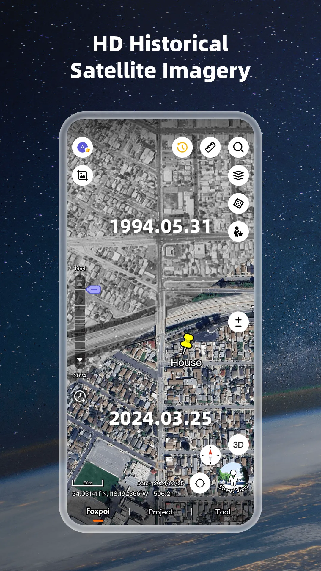
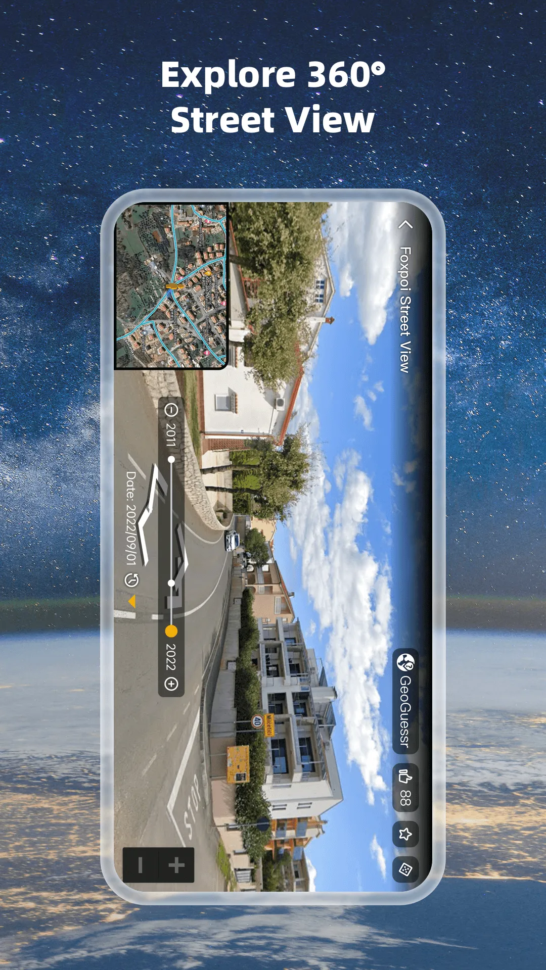
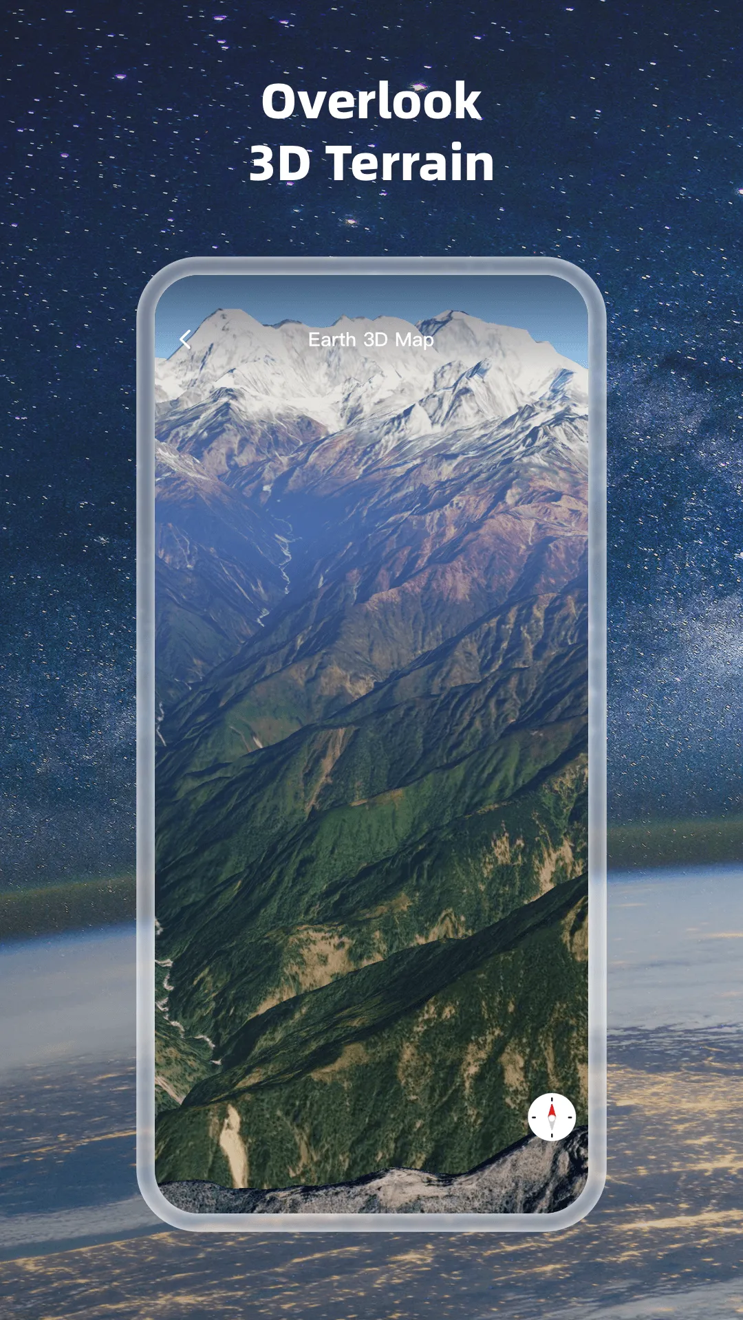
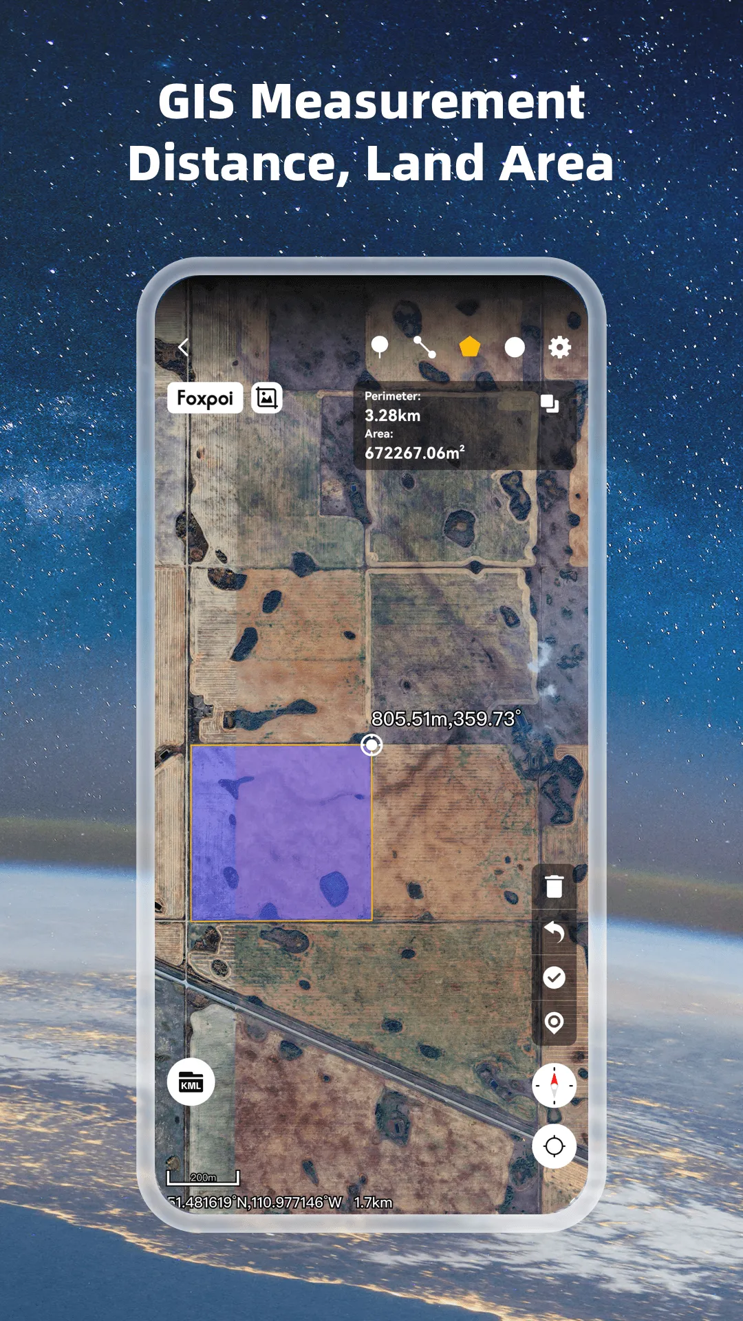
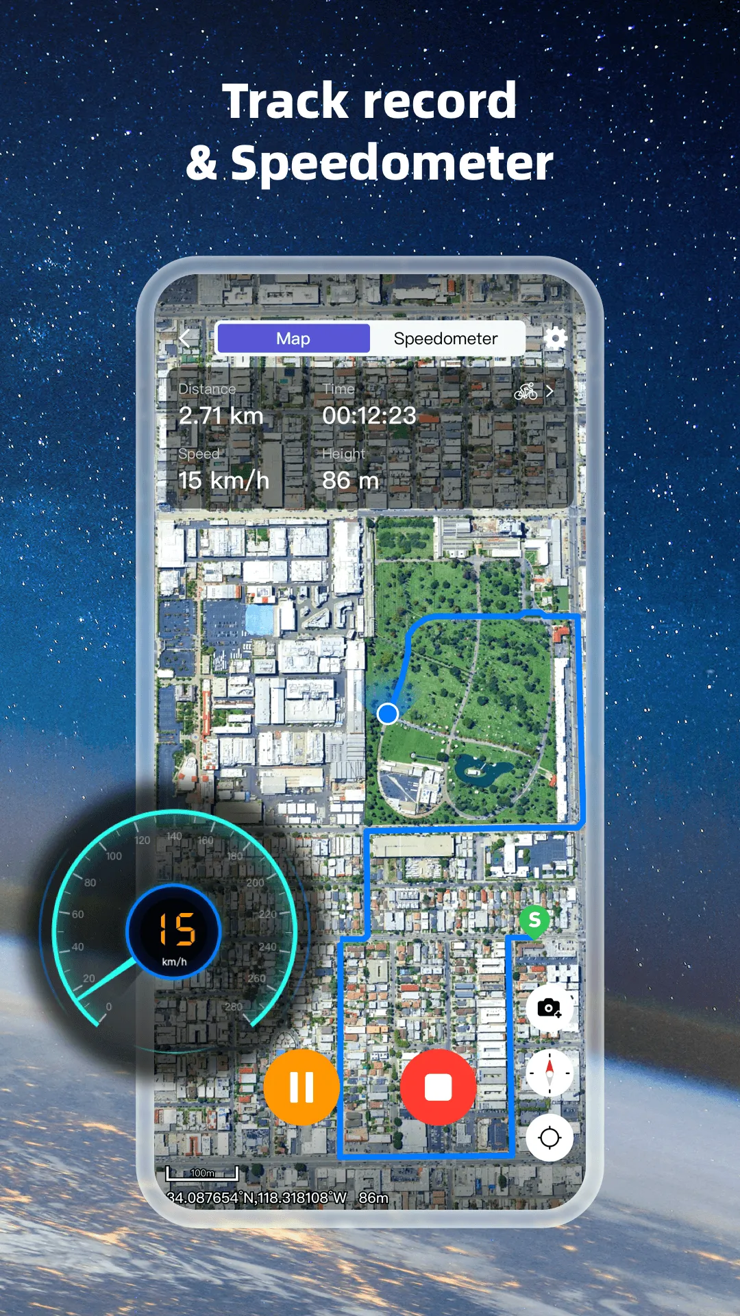
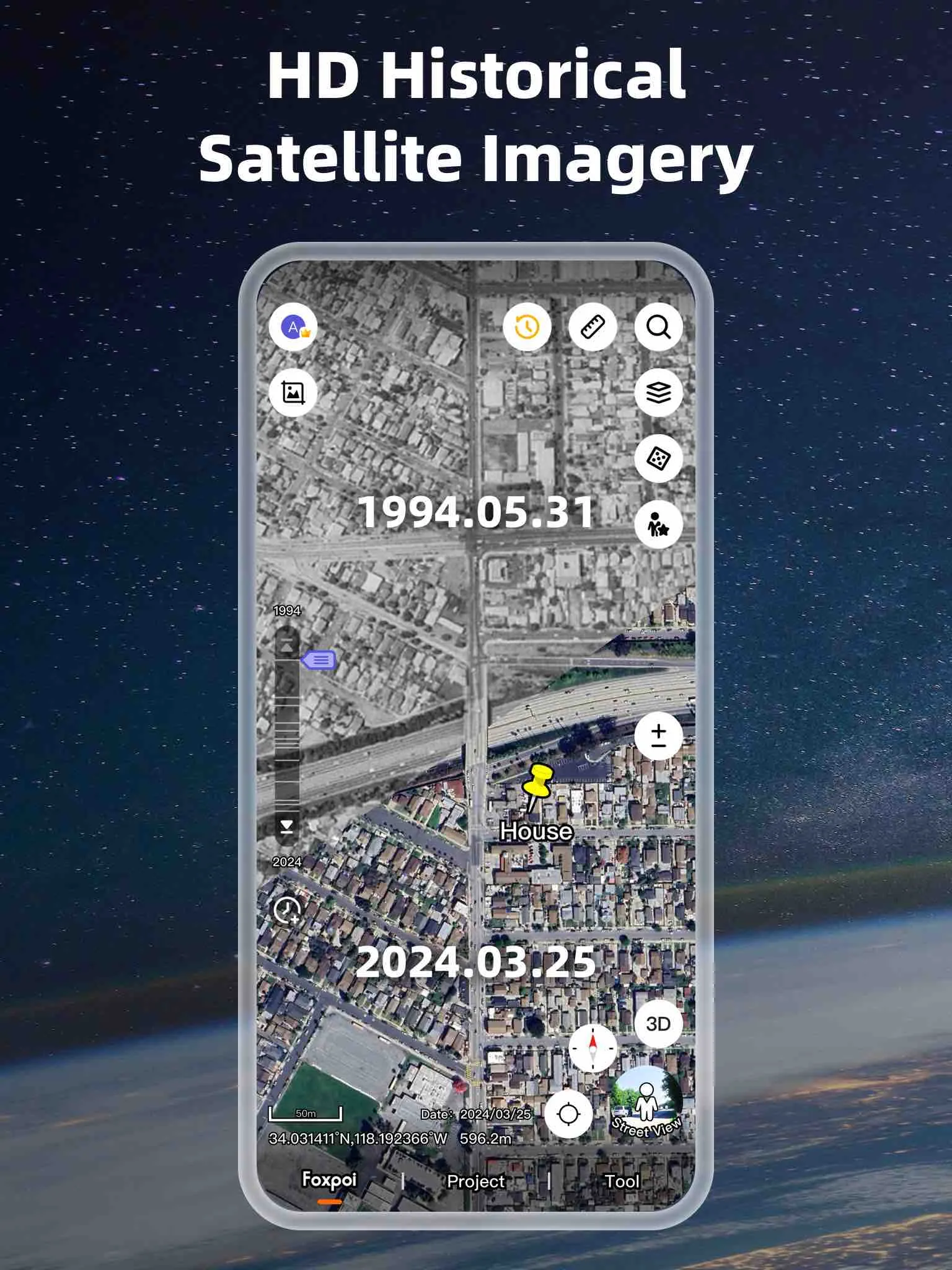
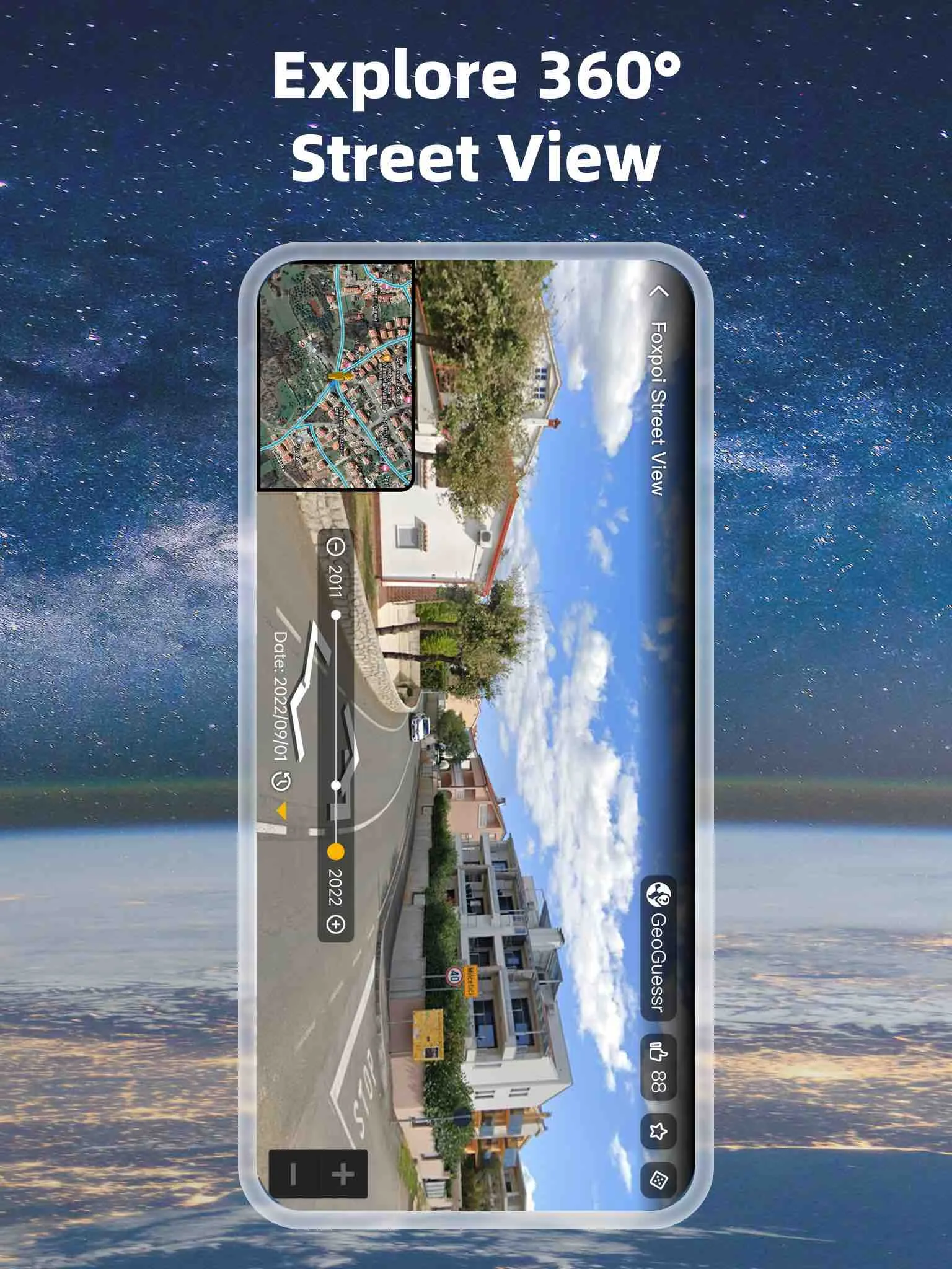
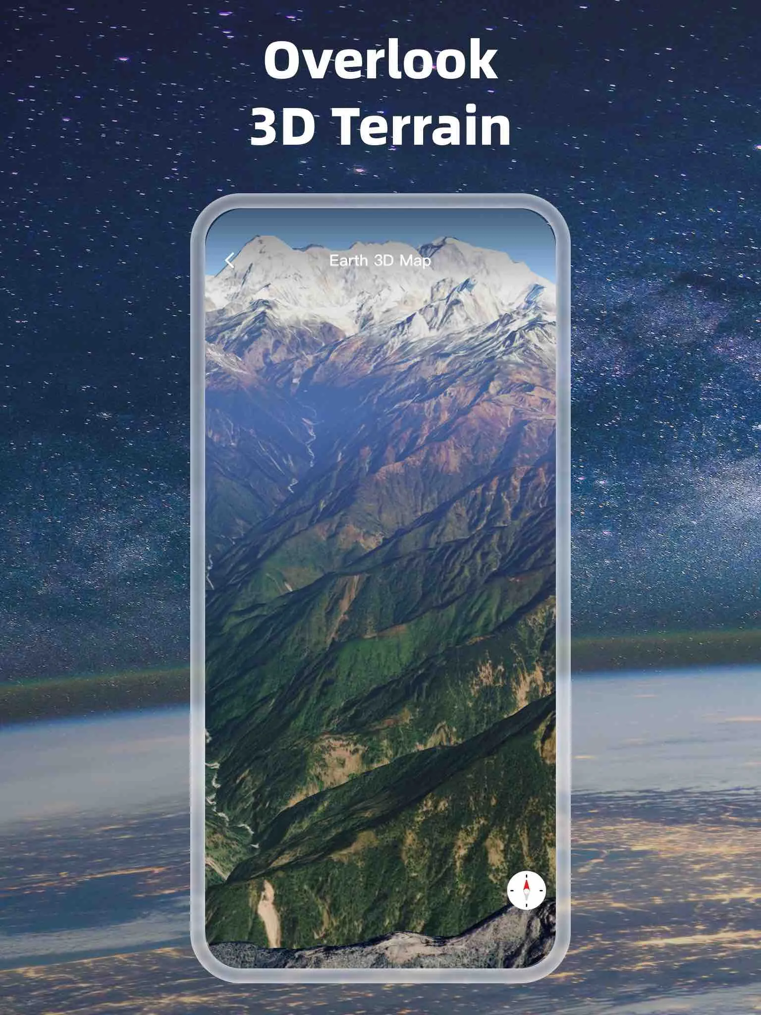
1.High-definition 3D globe 2.Load map tile data 3.Compass function 4.Historical street view 5.Measuring area distance 6.Latest satellite imagery 7.World map&Satellite map Earth 3D Map allows you to view any place on Earth using photos taken from satellites. The advantage of the Earth 3D Map over other maps is that the satellite map allows you to consider the surface terrain, forests, rivers, lakes, buildings, roads in sufficient detail with a high degree of detail. With satellite maps, you can
Developer info