Distance & Land Area Measure
Verified | 2.0 Rating |
About App
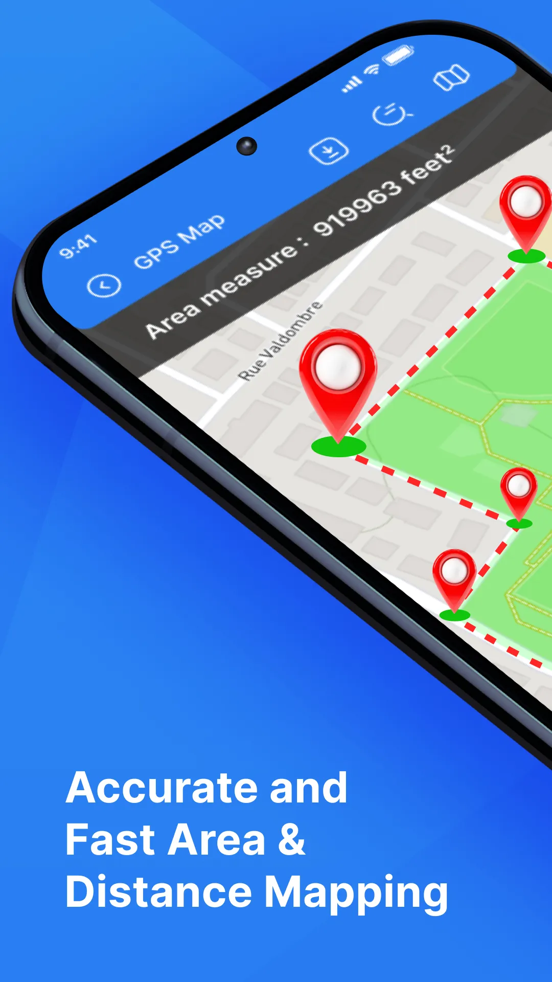
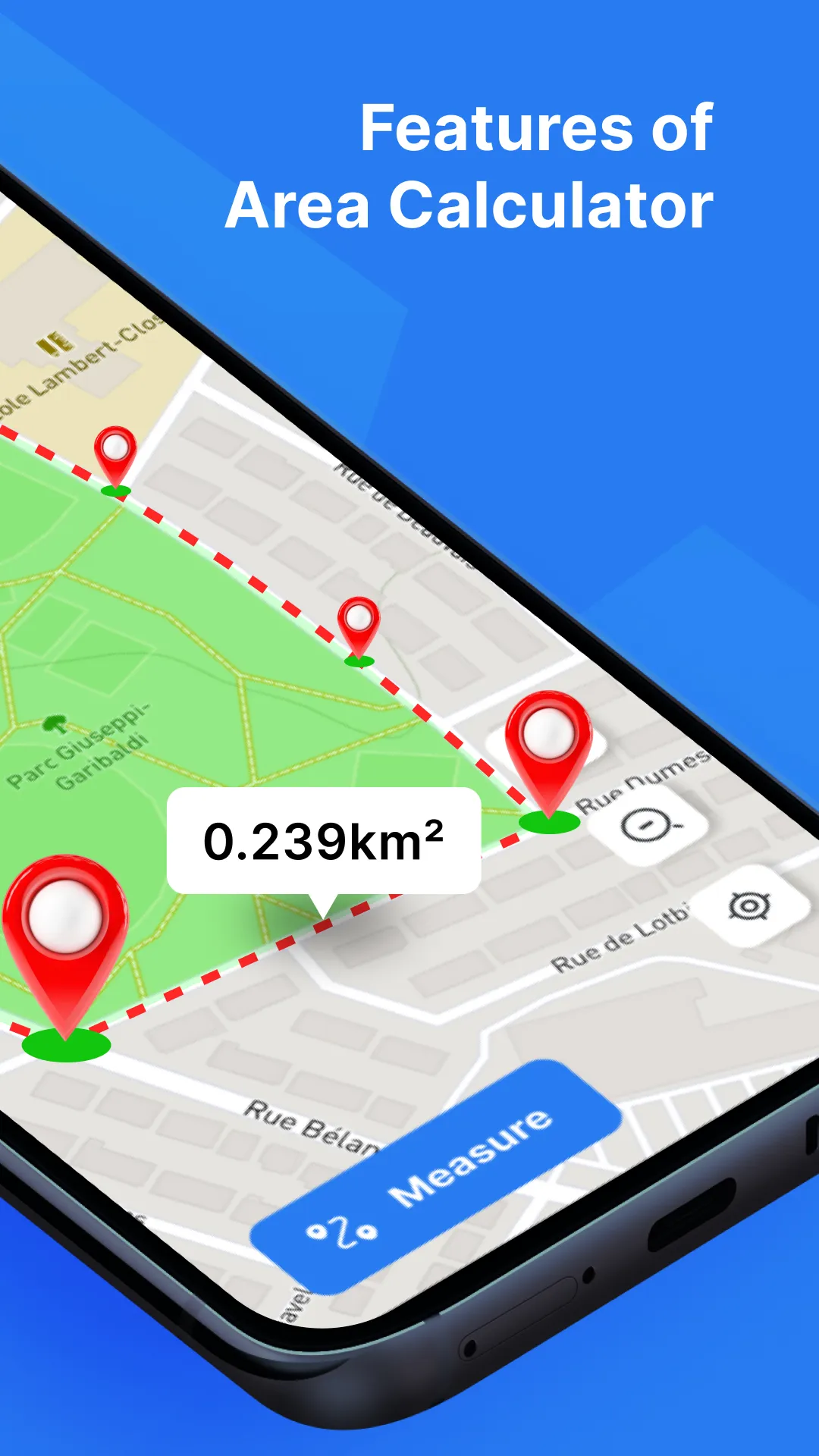
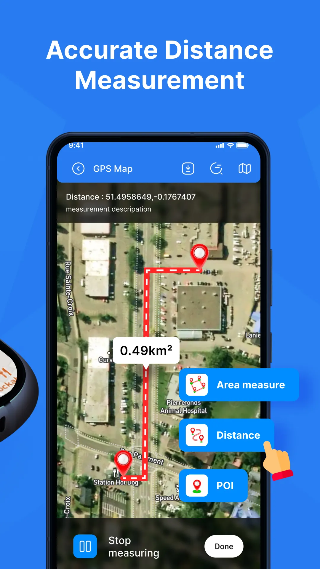
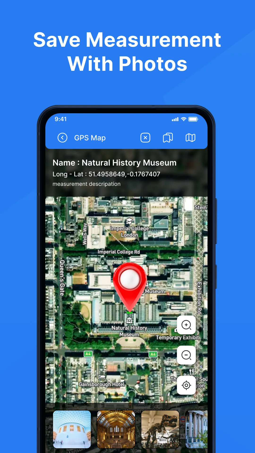
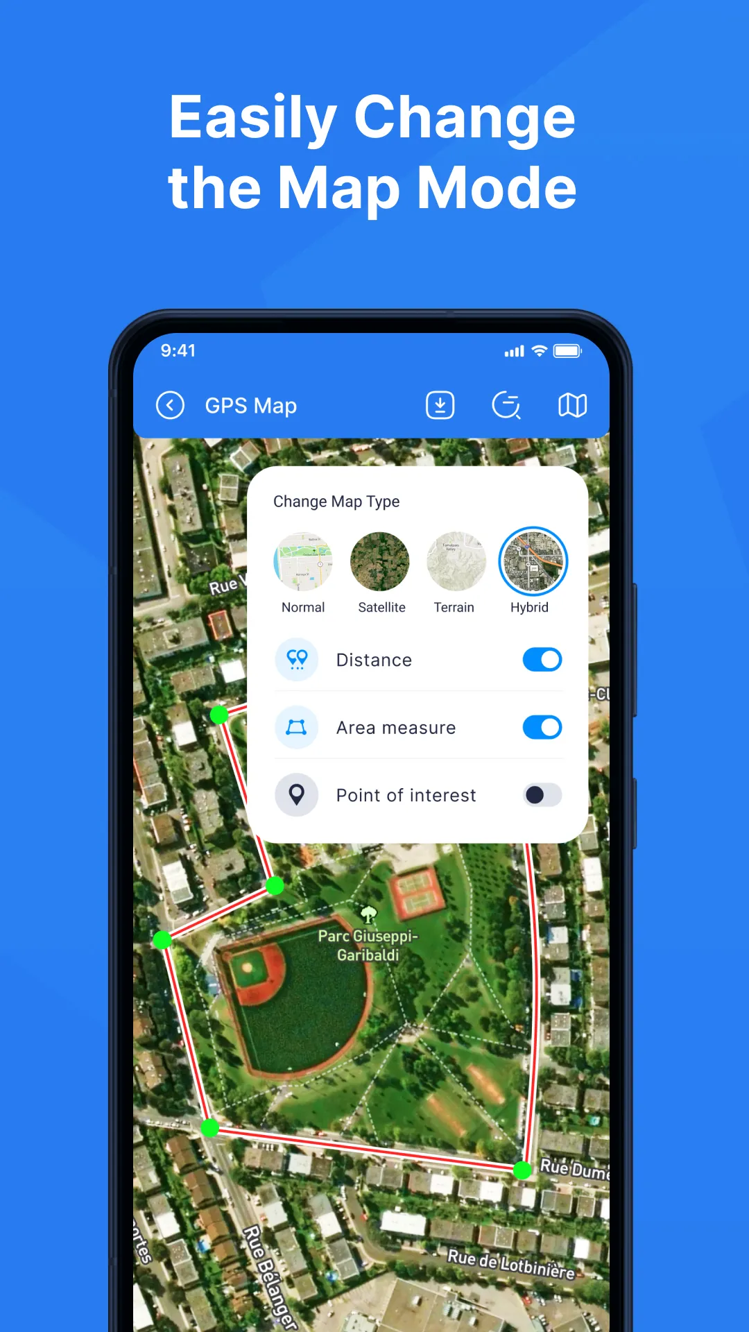
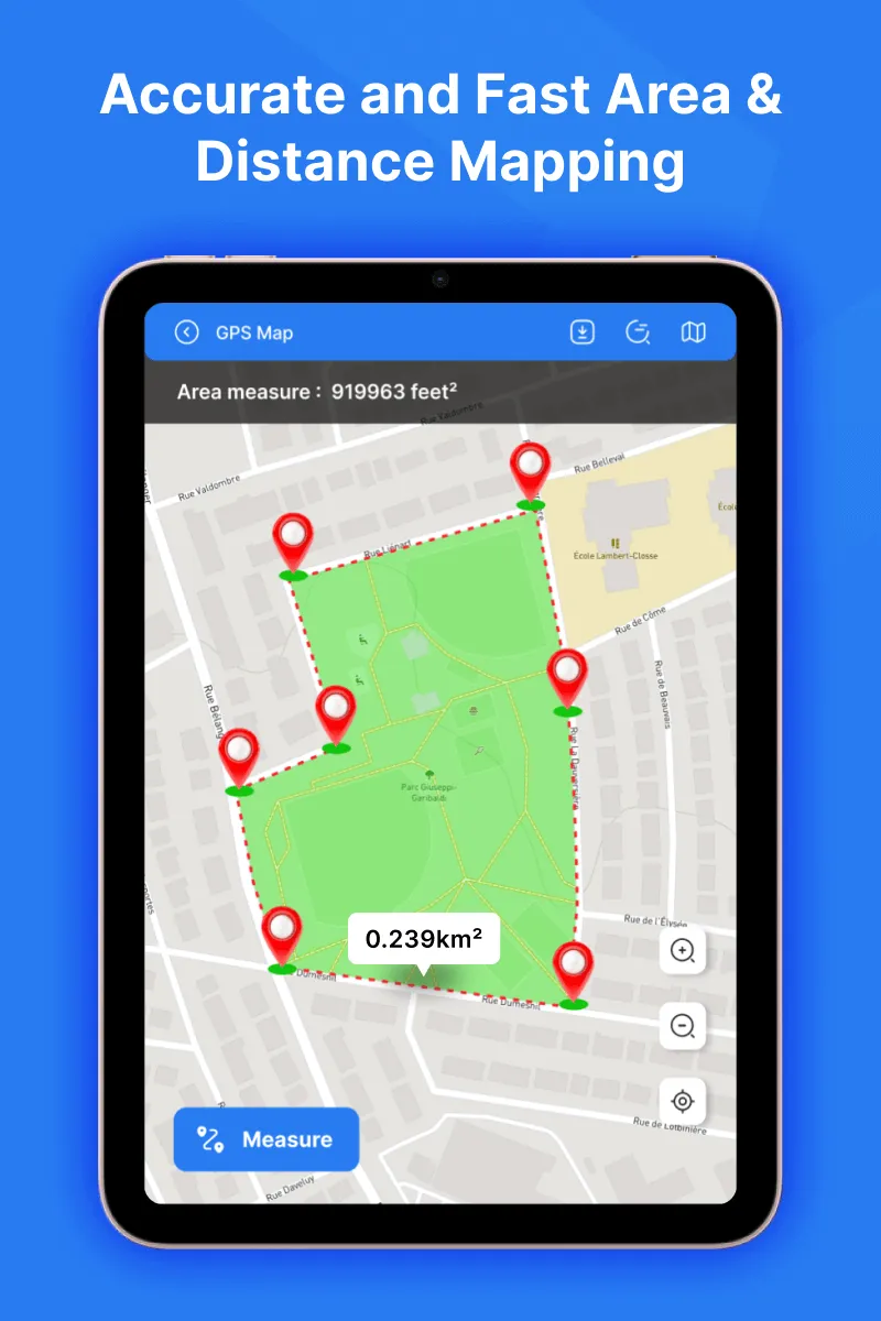
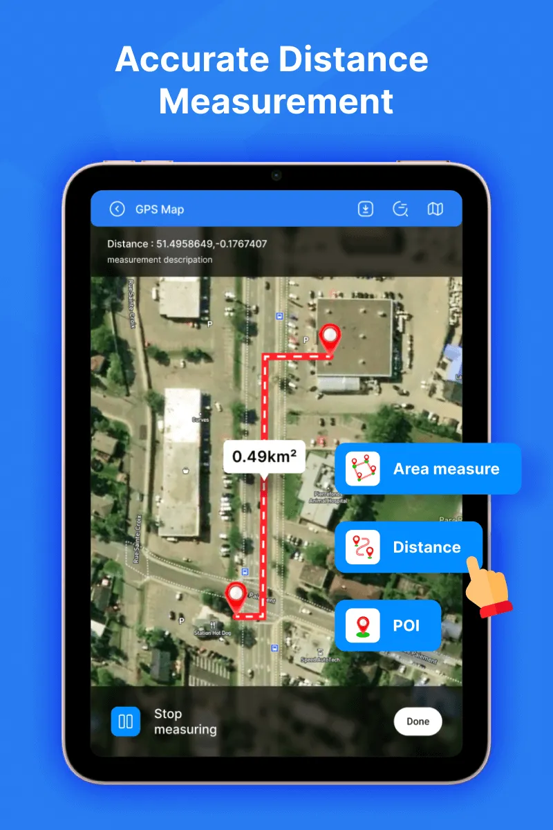
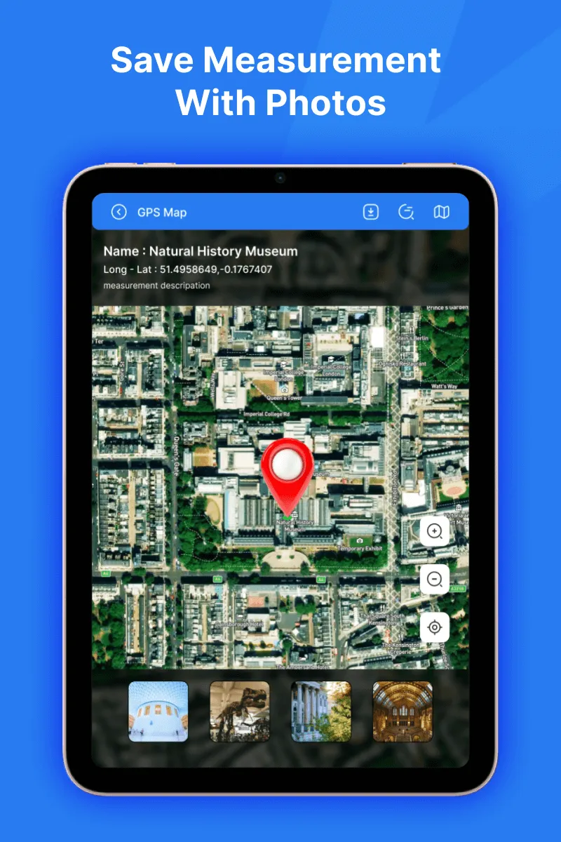
Distance & Land Area MeasurementThe app is useful to calculate GPS area and GPS distance with great accuracy. You can use POI to specific point locations.It is fast, simple, and easy to use. You can calculate measurements by GPS measurement and manual measurement. If you can measure any place or place area on a map by sitting at your current location using this Distance and Land Area Measurement app. Simply select the area you want to measure on the map. This application helps to calculate the distance between two or more points anywhere on the earth. In this, you can also choose the places from where you want to calculate the distance. For area and distance calculations, you just click on the map to place the first marker and then click again to position the second marker, through this you can mark the places you want to calculate. Want If you mark any wrong point you can delete it. You can even zoom in on the locations if you want. If you want to save the measurement field after the calculation is complete, you can save it by entering the measurement name and measurement description. You can also add images from the camera and gallery. POI- In the place of interest you just select the locations and it will show you the latitude and longitude of the selected locations. You can even save it....
Developer info
2.0
1 total rating(s)
5
0%
4
0%
3
0%
2
100%
1
0%
Popular Apps